Real-Time Tracking in Water Delivery Software: How It Works and Why It Matters
-

- April 22nd, 2026
- 467 views

Get a free topical map and start building content authority today.
Real-time tracking in water delivery software combines GPS, telematics, cellular connectivity, and cloud services to show where trucks and tankers are, what they carry, and when deliveries complete. This article explains how the system components fit together, what data flows matter, and practical steps to evaluate or deploy tracking for a water delivery operation.
Real-time tracking systems collect location and sensor data from truck-mounted devices, send it through cellular or satellite networks, process it in cloud platforms, and present it to dispatchers and managers via dashboards and alerts. Key considerations include connectivity, data accuracy, integration with route optimization, and security. This guide includes a TRACK checklist, a short scenario, actionable tips, common mistakes, and five core cluster questions for further reading.
Detected intent: Informational
How real-time tracking in water delivery software works
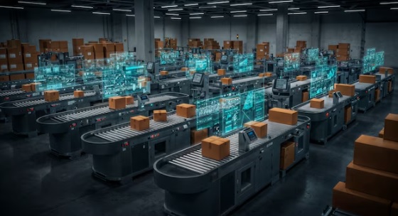
At its core, real-time tracking in water delivery software depends on three technical layers: endpoint telematics, data transport, and cloud processing. Endpoint telematics devices typically combine GPS receivers, cellular modems, and vehicle sensors (fuel level, tank level, pump status). Data transport uses LTE/5G, Wi-Fi, or satellite links to forward telemetry to a cloud platform that normalizes, stores, and enriches events for reporting and live maps.
Core components and data flow
1. Telematics and hardware
Telematics units (OEM-installed or aftermarket) collect GNSS coordinates, time stamps, speed, heading, and analog/digital inputs for tank level sensors and PTO/pump state. Many systems support CAN bus integration for richer vehicle diagnostics, which helps monitor engine hours and maintenance triggers.
2. Connectivity and transport
Cellular networks are the primary transport for urban and suburban fleets; satellite links serve remote routes. Typical deployments batch non-critical telemetry and stream high-priority events (e.g., missed delivery window, route deviation) to conserve bandwidth and cost.
3. Cloud processing and APIs
Cloud platforms receive raw telemetry, apply filtering and smoothing, perform reverse geocoding, and expose APIs for dashboards, mobile apps, and integrations with billing or inventory systems. Real-time message brokers (MQTT or WebSocket) enable low-latency updates to operator consoles.
Key features that matter for water delivery
Route optimization and live rerouting
Delivery route optimization for water trucks must consider vehicle weight limits, access restrictions, delivery window constraints, and refill station locations. When real-time tracking exposes delays or traffic, software can recompute routes and dispatch reroute messages to drivers.
Load-level and pump telemetry
Tank-level sensors and pump-state inputs let the system detect offloads, verify delivered volumes, and flag possible overfills or leaks. Integrating this data with invoicing reduces disputes and supports regulatory records.
Geofencing and alerts
Geofences trigger automatic events when a vehicle arrives at or leaves a customer site, or when it enters restricted zones. Alerts can be configured for late arrivals, unauthorized stops, or unexpected routes.
TRACK checklist: A quick evaluation framework
Use the TRACK checklist before purchasing or deploying a tracking solution:
- Telemetry: Does hardware capture GPS, tank level, and pump state?
- Reliability: Is connectivity resilient across service areas? Is offline data cached?
- APIs: Are open APIs available for integration with ERP or dispatch?
- Compliance: Does the system meet data retention and reporting needs?
- Key metrics: Can dashboards show on-time delivery, fuel use, and delivered volume?
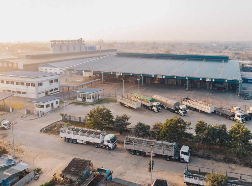
Real-world example
Scenario: A regional bottled-water supplier operates 12 delivery trucks serving retail and office customers. After installing telematics and tank-level sensors, dispatchers receive live location and delivered-volume events. When a downtown traffic incident delays a truck, the system flags an at-risk delivery, and the dispatcher reroutes a nearby truck. Automated geofence events mark completed drops and trigger electronic proof-of-delivery records, reducing billing disputes and improving on-time performance by measurable percentages over three months.
Practical tips for implementation
- Start with a pilot fleet (3–5 vehicles) covering typical routes to validate signal coverage, sensor accuracy, and integration points.
- Prioritize core KPIs: on-time delivery rate, average response time to exceptions, and delivered volume accuracy.
- Choose devices that support remote firmware updates and diagnostic logs to reduce service visits.
- Define event thresholds (e.g., tank-change delta for a valid delivery) to avoid false positives from sensor noise.
- Secure telemetry with encryption in transit and role-based access control for dashboards; follow recognized cybersecurity guidance such as the NIST Cybersecurity Framework (NIST).
Common mistakes and trade-offs
Choosing the wrong balance between data granularity and cost is a frequent mistake. High-frequency polling improves accuracy but increases cellular costs and battery drain. Another common issue is over-relying on GPS alone; urban canyons can cause position drift and misidentify geofence events. Integrating auxiliary sensors (odometer, accelerometer, tank level) and using map-matching algorithms reduces errors.
Trade-offs to consider:
- Cost vs. fidelity: Decide which events require real-time streaming (e.g., missed delivery) and which can be batched (routine telemetry).
- Complexity vs. usability: Advanced optimization features add value but may require process changes and training.
- Privacy vs. transparency: Driver privacy policies must be balanced against operational visibility; consider policies for off-duty tracking.
Integration and scalability
Plan integrations with billing, inventory, and customer portals from the start. Use standard data schemas and RESTful or event-driven APIs to reduce future rework. For scalability, prefer cloud platforms with elastic ingestion pipelines and message queuing to handle peak telemetry bursts during dense delivery windows.
Core cluster questions
- What sensors are required for accurate tank-level monitoring in delivery trucks?
- How does route optimization integrate with live traffic and delivery windows?
- What are best practices for securing telematics data in fleet applications?
- How to design exception workflows for missed or partial deliveries?
- What metrics demonstrate ROI for real-time tracking in distribution fleets?
Implementation checklist
Before full rollout, confirm the following:
- Pilot completed with representative routes and sensors validated.
- API endpoints tested with billing and dispatch systems.
- Alert thresholds and geofences configured and tested for false positives.
- Data retention and access policies documented; security controls in place.
- Operator training on dashboard, mobile app, and exception handling completed.
Additional considerations
Regulatory compliance for transport and water delivery records varies by jurisdiction. Check local requirements for electronic delivery records, weight limits, and hazardous materials rules if applicable. Also confirm insurance and contractual obligations around proof-of-delivery formats.
Secondary keywords and related terms
Secondary keywords used in this article: fleet GPS tracking for water delivery; delivery route optimization for water trucks. Related entities and synonyms: telematics, tank-level sensors, geofencing, route planner, cloud telematics, MQTT, CAN bus, GNSS, proof of delivery.
FAQ
How does real-time tracking in water delivery software work?
Real-time tracking collects GPS and sensor data from telematics devices on vehicles, transmits data over cellular or satellite links, processes it in cloud services, and presents live maps, alerts, and reports to dispatchers and managers. Integration with route optimization and tank-level sensors enables automated proof-of-delivery and exception handling.
What is the accuracy of tank-level sensors and when should calibration occur?
Accuracy depends on sensor type (ultrasonic, pressure, float). Typical field accuracy ranges from ±1% to ±5% of tank volume. Calibrate sensors during initial installation and after any maintenance that affects tank geometry or fittings; schedule periodic recalibration based on operational use.
How can deliveries be rerouted in real time when delays occur?
When a delay or disruption is detected, the system checks nearby available vehicles, recalculates routes considering delivery windows and vehicle capacity, and sends an updated route to the driver’s app. Prioritization rules and manual dispatcher overrides should be part of the workflow.
What are common security risks for telematics systems and how are they mitigated?
Common risks include unsecured APIs, unencrypted telemetry, and weak authentication. Mitigations include TLS encryption, token-based authentication, least-privilege access, logging and monitoring, and adherence to cybersecurity frameworks such as the NIST Cybersecurity Framework (NIST).
Can tracking systems integrate with billing and inventory systems?
Yes. Most modern tracking platforms expose RESTful APIs or webhook events to send completed delivery records, delivered volumes, timestamps, and GPS proofs for automatic invoicing and inventory reconciliation. Confirm data formats and mapping during implementation planning.