How Geospatial Data Is Helping Governments Make Data-Driven Decisions

Strong 8k brings an ultra-HD IPTV experience to your living room and your pocket.
In today’s complex and fast-paced world, governments are tasked with addressing a wide range of challenges, from urbanization and climate change to resource management and public safety. To navigate these complexities effectively, decision-makers need accurate, timely, and actionable information. This is where geospatial data solutions come into play. By providing detailed insights about the physical world and human activity, geospatial data empowers governments to make more informed decisions, improve public services, and enhance the quality of life for citizens.
Understanding Geospatial Data
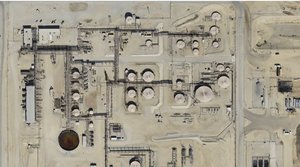
Geospatial data refers to information that has a geographic component. This data can describe objects, events, or phenomena with a specific location on the Earth’s surface. It encompasses a variety of data types, including satellite imagery, aerial photography, LiDAR scans, GPS data, and geographic information system (GIS) datasets. Governments collect, analyze, and interpret geospatial data to understand spatial relationships, monitor changes over time, and predict future trends.
Urban Planning and Land Management
One of the most significant applications of geospatial data in government decision-making is urban planning and land management. As cities expand and populations grow, urban planners face increasing pressure to design sustainable, livable, and efficient communities. Geospatial data provides detailed maps and analyses that help planners assess land use patterns, transportation networks, and population density. By leveraging this information, governments can identify suitable locations for new housing developments, transportation corridors, parks, and public facilities.
Moreover, geospatial data aids in zoning regulations and land-use planning by ensuring that development projects align with environmental guidelines and community needs. Planners can evaluate the impact of proposed developments on traffic flow, green spaces, and infrastructure capacity. This results in more balanced, data-driven urban growth that minimizes congestion and preserves natural resources.
Disaster Management and Emergency Response
Governments are increasingly relying on geospatial data to enhance disaster management and emergency response capabilities. During natural disasters such as hurricanes, floods, and wildfires, real-time geospatial information enables emergency services to assess the extent of the damage, identify affected areas, and coordinate rescue operations. Satellite imagery and drone surveys provide up-to-date visual data that help first responders navigate hazardous environments and deliver aid to those in need.
Additionally, geospatial data supports risk assessment and disaster preparedness. By analyzing historical data on natural hazards and environmental conditions, governments can identify high-risk areas and develop mitigation strategies. For example, flood risk maps can guide infrastructure investments such as the construction of levees and drainage systems. Early warning systems, powered by geospatial analytics, alert communities to impending threats, giving residents time to evacuate and take protective measures.
Environmental Monitoring and Conservation
Environmental protection is a critical priority for governments worldwide. Geospatial data plays a pivotal role in monitoring ecosystems, managing natural resources, and enforcing environmental regulations. Remote sensing technologies, such as satellite imagery and aerial surveys, enable governments to track deforestation, monitor water quality, and detect pollution sources.
By analyzing spatial patterns and trends, policymakers can identify areas of environmental degradation and prioritize conservation efforts. For instance, geospatial data can reveal the encroachment of human activities into protected areas, prompting timely intervention to prevent habitat loss. Governments can also use this data to enforce fishing quotas, manage wildlife populations, and track the health of forests and wetlands.
Furthermore, geospatial data supports climate change mitigation and adaptation strategies. By mapping carbon emissions, monitoring sea-level rise, and analyzing temperature trends, governments can develop policies that address the causes and impacts of climate change. This data-driven approach enhances the effectiveness of environmental initiatives and promotes sustainable development.
Transportation and Infrastructure Development
Efficient transportation systems and robust infrastructure are essential for economic growth and public well-being. Geospatial data helps governments plan, design, and manage transportation networks and infrastructure projects more effectively. By analyzing traffic patterns, population distribution, and land use, transportation planners can identify areas with high demand for public transit services and optimize routes for buses and trains.
Geospatial data also supports the design and construction of roads, bridges, and utilities. Engineers use digital elevation models, soil data, and hydrological information to assess site suitability and mitigate construction risks. Additionally, geospatial analysis aids in predicting maintenance needs and monitoring infrastructure health, reducing the likelihood of costly repairs and service disruptions.
Smart city initiatives often integrate geospatial data with other technologies to enhance urban mobility and infrastructure management. For example, real-time traffic monitoring systems use geospatial data to detect congestion and suggest alternative routes. This leads to reduced travel times, lower emissions, and improved quality of life for residents.
Public Health and Disease Control
Geospatial data has proven to be an invaluable tool in public health and disease control efforts. By mapping the spread of infectious diseases, governments can identify hotspots, allocate resources, and implement targeted interventions. During public health emergencies, such as pandemics, geospatial data enables authorities to monitor case numbers, track contact tracing efforts, and evaluate the effectiveness of containment measures.
Spatial analysis helps public health officials understand the relationship between environmental factors and health outcomes. For instance, mapping air quality data alongside respiratory illness rates can reveal correlations that inform policy decisions. Governments can use this information to implement regulations that reduce pollution and promote healthier living environments.
In rural and underserved areas, geospatial data aids in identifying gaps in healthcare access. By analyzing population density and proximity to healthcare facilities, policymakers can prioritize investments in new clinics, telehealth services, and transportation options to ensure equitable healthcare access for all citizens.
Security and Law Enforcement
Ensuring public safety and maintaining law and order are fundamental responsibilities of government agencies. Geospatial data supports security and law enforcement by providing spatial insights into crime patterns and security threats. By mapping crime incidents and analyzing trends, law enforcement agencies can deploy resources more effectively and develop targeted crime prevention strategies.
Geospatial analysis helps identify areas with high crime rates, known as hotspots, allowing authorities to focus patrols and community engagement efforts in these locations. Additionally, spatial data is used in forensic investigations to reconstruct crime scenes, track suspect movements, and gather evidence.
In the context of national security, geospatial data supports border management, surveillance, and intelligence gathering. Governments use satellite imagery, drones, and GIS tools to monitor borders, detect unauthorized activities, and protect critical infrastructure. This enhances situational awareness and enables timely responses to potential threats.
Economic Development and Resource Allocation
Governments play a vital role in promoting economic development and ensuring equitable distribution of resources. Geospatial data provides the insights needed to identify opportunities for investment, prioritize development projects, and allocate public funds effectively. By analyzing demographic data, economic indicators, and land use patterns, policymakers can pinpoint regions that require infrastructure upgrades, job creation initiatives, and social services.
For example, geospatial data can reveal areas with high unemployment rates and limited access to education and healthcare. Governments can use this information to design targeted programs that address the specific needs of disadvantaged communities. In addition, spatial analysis supports tourism development by identifying natural attractions, historical sites, and recreational areas that can be promoted to boost local economies.
Geospatial data also facilitates land valuation and taxation. Accurate mapping of property boundaries and land use ensures fair property assessments and helps governments generate revenue for public services. This data-driven approach enhances transparency and accountability in public finance management.
Citizen Engagement and Transparency
Geospatial data enhances citizen engagement and government transparency by providing accessible and visual information about public initiatives. Interactive maps and dashboards allow citizens to explore data on infrastructure projects, environmental conditions, and public services in their communities. This fosters a sense of inclusion and empowers citizens to participate in decision-making processes.
Open data initiatives that share geospatial information with the public promote accountability and build trust between governments and citizens. By making data available, governments enable researchers, businesses, and non-profit organizations to develop innovative solutions that address societal challenges. Crowdsourcing initiatives, where citizens contribute data on issues such as potholes, pollution, or public safety concerns, further enhance the quality and relevance of geospatial data.
Challenges and Considerations
While geospatial data offers numerous benefits for government decision-making, there are challenges that must be addressed. Data accuracy, completeness, and timeliness are critical for reliable analysis. Governments need robust data collection and validation processes to ensure data quality. Privacy and security concerns also arise, especially when dealing with sensitive information about individuals and communities. Governments must implement strict data protection measures and ethical guidelines to safeguard privacy rights.
Interoperability and standardization are additional considerations. Geospatial data is often collected and managed by different agencies using various formats and technologies. Ensuring compatibility and seamless data sharing requires adherence to common standards and the development of integrated data platforms.
Capacity building and training are essential to maximize the potential of geospatial data. Governments need skilled personnel who can collect, analyze, and interpret spatial data effectively. Investment in education and professional development programs ensures that government agencies have the expertise needed to leverage geospatial technologies for informed decision-making.
Conclusion
Geospatial data is transforming the way governments make decisions, plan services, and engage with citizens. By providing a deeper understanding of spatial relationships and trends, geospatial data empowers policymakers to develop evidence-based strategies that address complex challenges. From urban planning and disaster management to public health and economic development, the applications of geospatial data are vast and impactful.
As technology continues to evolve, the integration of geospatial data with emerging tools such as artificial intelligence, machine learning, and big data analytics will further enhance government capabilities. By embracing geospatial data solutions, governments can build more resilient, sustainable, and inclusive societies that improve the lives of their citizens.
Note: IndiBlogHub features both user-submitted and editorial content. We do not verify third-party contributions. Read our Disclaimer and Privacy Policyfor details.


