When to Trek Nag Tibba: Best Seasons, Conditions, and Practical Tips
-
- February 23rd, 2026
- 1,547 views

FREE SEO Topical Map Generator: Find Your Next Content Ideas
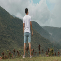
The Best time to visit Nag Tibba trek depends on objectives such as clear summit views, snow trekking, or avoiding rain. Nag Tibba (around 3,022 m) in Uttarakhand is a short, accessible Himalayan trek popular with beginners and weekend trekkers; choosing the right season affects weather, trail conditions, and safety.
- Best overall seasons: Spring (Mar–May) and Autumn (Sep–Nov) for stable weather and clear views.
- Winter (Dec–Feb): Snow on the summit; cold temperatures and limited services.
- Monsoon (Jun–Aug): Heavy rain, slippery trails, and higher landslide risk—generally not recommended.
- Typical itinerary: 2 days, base village Pantwari to summit, suitable for beginners with basic fitness.
Best time to visit Nag Tibba trek
Peak seasons and why they work
Autumn (September to November) and spring (March to May) are the most recommended periods. Post-monsoon autumn brings clear skies, stable weather, and excellent visibility of the Gangotri and Bandarpoonch ranges. Spring offers mild temperatures, blooming rhododendrons at lower elevations, and comfortable daytime hiking conditions.
Winter: snow experience and cold-weather considerations
December through February can provide snow-clad scenery on Nag Tibba. This season suits trekkers seeking a winter experience, but expect sub-zero nighttime temperatures, icy trails, and fewer support services. Proper cold-weather gear and experience with snow trekking or hiring an experienced guide are important.
Monsoon: when to avoid the trek
June to August is the monsoon period in Uttarakhand. Heavy rains make trails muddy and slippery, increase the chance of landslides on approach roads, and reduce visibility. For safety and trail preservation, it is generally advised to avoid the trek during peak monsoon months.
Weather, temperatures, and visibility
Typical temperature ranges
At the Nag Tibba summit (around 3,000 m): spring/autumn daytime temperatures range from about 5°C to 15°C; nights can drop close to freezing. In winter, daytime temperatures may stay below 5°C and nights often fall well below 0°C. Local valleys and the base village will be milder.
Checking forecasts and official sources
Before planning, check up-to-date forecasts from the India Meteorological Department and local advisories from Uttarakhand authorities. The India Meteorological Department provides regional forecasts and warnings that help assess weather-related risks and should be consulted before departure: India Meteorological Department.
Trail overview and difficulty
Route and duration
Typical itineraries start from the base village (often Pantwari) with a drive from Dehradun or Mussoorie, followed by a 6–10 km trek to the summit depending on the chosen route. Most groups complete Nag Tibba in 1–2 days, with an overnight camp at the ridge or the saddle before an early summit push.
Difficulty and fitness
The trek is rated easy to moderate: steady uphill sections but no technical climbing. Basic cardiovascular fitness and experience walking on uneven trails are sufficient. For winter snow or icy conditions, additional experience or a guide is advised.
Permits, guides, and local regulations
Permissions and forest rules
Permit requirements can vary. Check with the Uttarakhand Forest Department or local authorities about permits, night camping permissions, and any seasonal restrictions. Hiring a local guide supports the local economy and can improve safety and navigation, especially in adverse weather.
Rescue and emergency contacts
Carry contact details for local rescue services and be aware of the nearest medical facilities. Inform local authorities or the guesthouse/guide about the planned itinerary and expected return time.
Packing checklist and preparation tips
Essential gear
- Layered clothing: thermal base layer, insulating mid-layer, windproof/waterproof outer layer
- Sturdy hiking boots with ankle support
- Warm sleeping bag (for winter/snow camping)
- Headlamp, first-aid kit, water treatment options, sun protection
- Trekking poles for steep or icy sections
Health and acclimatization
Nag Tibba's altitude is moderate, but symptoms of altitude sickness can still occur. Allow a gradual ascent, stay hydrated, and spend extra time at intermediate elevations if feeling unwell. Consult official health guidance about altitude and travel safety before departure.
How to reach the trailhead
Nearest towns and transport
Dehradun and Mussoorie serve as common transit points. Road travel to the base village typically takes 2–4 hours depending on traffic and starting point. Local taxis, buses, or shared vehicles are commonly used to reach trailheads. Verify road conditions during the monsoon or winter seasons.
Local accommodation
Basic guesthouses and homestays are available in nearby villages and towns. Bookings are recommended during peak season weekends and holidays.
Environmental and cultural considerations
Leave-no-trace principles
Follow leave-no-trace practices: carry out all waste, avoid disturbing vegetation and wildlife, and use established campsites. Respect local customs and property while visiting villages along the route.
FAQ
What is the Best time to visit Nag Tibba trek?
Autumn (September–November) and spring (March–May) are generally the best times for stable weather and clear views. Winter offers snow but colder conditions; monsoon months are not recommended due to rain and landslide risk.
How difficult is the Nag Tibba trek for beginners?
The trek is suitable for beginners with moderate fitness. It involves steady uphill walking but no technical climbing. Hiring a local guide improves safety and navigation.
Are permits required to trek Nag Tibba?
Permit requirements can change. Check with the Uttarakhand Forest Department or local authorities before travel. Local guides and guesthouses can often advise on current rules.
Is camping available on the route?
Camping is common at the ridge or saddle below the summit. Use designated sites where possible and follow local regulations regarding campfires and waste disposal.
What safety precautions are recommended?
Monitor weather forecasts, carry appropriate clothing and gear, inform someone about the itinerary, consider hiring a guide, and be prepared to turn back in unsafe conditions. For severe weather or medical emergencies, contact local rescue services immediately.
References: India Meteorological Department forecasts and local Uttarakhand forest and tourism advisories provide official guidance on weather and permits.