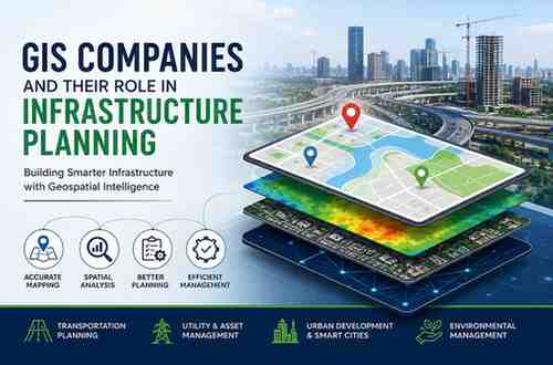
How GIS Companies Support Modern Infrastructure Planning
-

- July 02nd, 2026
- 633 views

FREE SEO Topical Map Generator: Find Your Next Content Ideas
Infrastructure projects require accurate data, efficient planning, and informed decision-making to ensure long-term success. Whether developing transportation networks, utility systems, industrial facilities, or smart cities, organizations need reliable spatial insights to reduce risks and optimize resources. This is where GIS companies play a crucial role.
By leveraging advanced geospatial technologies, GIS companies help planners, engineers, and government agencies understand complex geographic information and make data-driven decisions. Through GIS mapping, spatial analysis, and location intelligence, these organizations contribute significantly to modern infrastructure development.
The Growing Need for Geospatial Services in Infrastructure Projects
Infrastructure planning involves multiple factors, including land use, environmental conditions, population growth, accessibility, and existing assets. Managing this information without a structured approach can lead to delays and costly mistakes.
Geospatial services provide a comprehensive view of project areas by integrating geographic data from multiple sources. This allows stakeholders to visualize project locations, identify potential challenges, and evaluate development opportunities before construction begins.
As infrastructure projects become more complex, the demand for geospatial services continues to grow across industries such as transportation, utilities, telecommunications, and urban development.
How a GIS Service Provider Improves Project Planning
A professional GIS service provider helps organizations transform raw geographic data into meaningful insights. Instead of relying on traditional planning methods, project teams can use GIS-based analysis to make informed decisions throughout the project lifecycle.
From site selection and route optimization to asset management and environmental assessment, a GIS service provider delivers solutions that improve efficiency and reduce operational risks. Access to accurate spatial information enables project managers to allocate resources effectively and maintain better control over project timelines.
Site Selection Made Smarter with GIS
One of the most important stages of infrastructure planning is selecting the right location. GIS companies help organizations evaluate multiple geographic factors before making investment decisions.
Using geospatial services, planners can analyze terrain, transportation access, utility availability, environmental constraints, and population distribution. This data-driven approach ensures that infrastructure projects are developed in locations that maximize value while minimizing risks.
For example, when planning a new industrial facility or transportation corridor, GIS-based analysis can identify the most suitable sites based on operational and environmental requirements.
GIS Companies and Transportation Infrastructure
Transportation infrastructure forms the backbone of economic development. Roads, railways, airports, and transit systems require detailed planning to meet growing mobility demands.
GIS companies support transportation planning by analyzing traffic patterns, identifying congestion areas, and evaluating future growth trends. These insights help authorities design efficient transportation networks that improve connectivity and reduce travel times.
Geospatial services also support ongoing maintenance activities by providing accurate information about transportation assets and infrastructure conditions.
Managing Critical Assets Through Geospatial Services
Infrastructure assets such as water pipelines, power distribution networks, and telecommunications systems require continuous monitoring. Effective asset management is essential for maintaining service reliability and reducing maintenance costs.
A GIS service provider helps organizations create centralized asset databases that combine location information with operational data. This allows utility companies and infrastructure operators to monitor assets, schedule maintenance activities, and respond quickly to issues.
With the support of geospatial services, organizations can improve asset visibility, increase operational efficiency, and extend infrastructure lifespan.
Supporting Smart City Development
Cities around the world are investing in digital technologies to improve urban living. GIS companies are playing a key role in this transformation by providing location intelligence and geospatial solutions.
Smart city initiatives rely on accurate geographic information to manage transportation systems, public services, utilities, and environmental resources. Geospatial services enable city planners to visualize urban environments, identify trends, and make informed decisions that enhance sustainability and quality of life.
As urban populations continue to expand, GIS technology will remain a critical component of smart city planning and development.
The Future of GIS in Infrastructure Planning
The integration of satellite imagery, artificial intelligence, cloud computing, and real-time data analytics is expanding the capabilities of modern GIS solutions. As a result, GIS companies are able to provide deeper insights and more accurate forecasting than ever before.
Organizations that partner with an experienced GIS service provider can benefit from advanced geospatial services that support better planning, improved efficiency, and long-term infrastructure sustainability.
Conclusion
Infrastructure development depends on accurate information and effective decision-making. GIS companies help organizations achieve these goals through innovative geospatial services that support planning, analysis, and asset management. Whether it is transportation planning, utility management, site selection, or smart city development, a trusted GIS service provider can deliver the spatial intelligence needed to ensure project success.
As infrastructure demands continue to grow, the role of GIS companies and geospatial services will become increasingly important in building resilient and sustainable communities.