Complete Planning Guide for Dayara Bugyal Trek 2024: Routes, Permits, and Safety
-

- February 23rd, 2026
- 1,026 views

👉 Best IPTV Services 2026 – 10,000+ Channels, 4K Quality – Start Free Trial Now
The Dayara Bugyal Trek 2024 is an alpine meadow trek in the Garhwal Himalaya of Uttarakhand that attracts hikers for sweeping grasslands, panoramic views of peaks such as Bandarpunch and Kalanag, and seasonal wildflowers. This guide explains routes, seasonality, permits, difficulty, logistics, and safety considerations for people planning the trek in 2024.
- Location: Dayara Bugyal, Uttarkashi district, Uttarakhand, India
- Typical duration: 3–6 days depending on route and pace
- Elevation: Meadows around 3,300–3,600 m (approx.)
- Best time: May–June (spring), September–November (autumn); winter snow possible
- Permits: Local forest or tourism permits may be required; check Uttarakhand authorities
Dayara Bugyal Trek 2024: Overview
What is Dayara Bugyal?
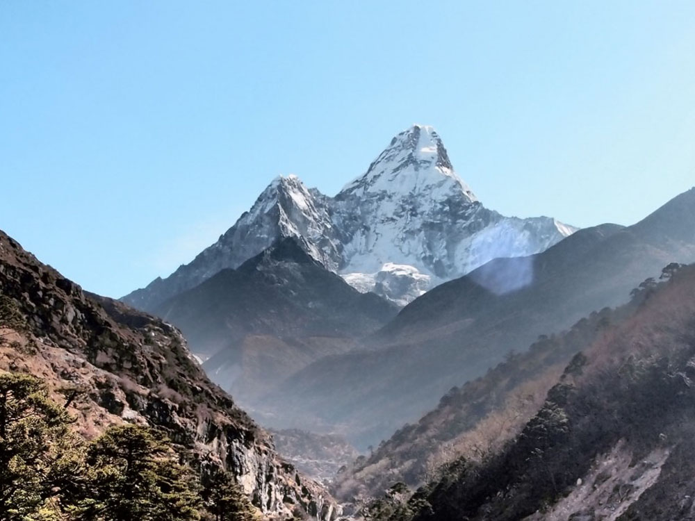
Dayara Bugyal (bugyal meaning alpine meadow) is a high-altitude meadow region in the Garhwal Himalaya. The landscape consists of vast grassy slopes, seasonal flowers and mixed conifer forests at lower elevations. From the meadows, trekkers get panoramic views of the Greater Himalaya, including peaks in the Bandarpunch range and nearby snowfields.
Why trek there in 2024?
A combination of relatively gentle terrain for Himalayan treks and scenic meadows makes Dayara Bugyal a popular choice for both new and experienced trekkers. Seasonal conditions vary year to year, so check local forecasts and official Uttarakhand advisories if planning for 2024.
Getting There and Typical Routes
Starting points and approach
Common approaches begin from Dehradun, followed by road travel to the trailhead near Raithal or Osla village (Uttarkashi district). Road travel typically takes several hours from Dehradun to the base village; public buses and shared taxis service these routes, while private vehicles can access nearer points where roads permit.
Popular routes
1) Raithal/Osla route: A well-known route with a mix of forested trails and open meadows. 2) Dayara via Barsi village: Slightly longer but offers different viewpoints and village interactions. 3) Snow routes in winter: Access and difficulty change when snow is present; experienced winter mountaineering techniques and equipment become necessary.
Seasonal Conditions and Best Time to Visit
Spring and autumn
May–June and September–November are generally considered the best windows for trekking: stable weather, clear mountain views, and accessible trails. Spring brings wildflower blooms; autumn offers crisp skies.
Monsoon and winter
Monsoon (July–August) brings heavy rain and slippery trails; landslide risk increases on mountain roads. Winter (December–March) often brings deep snow and sub-zero temperatures—suitable only for experienced winter trekkers with appropriate gear and local guidance.
Permits, Local Rules, and Responsible Trekking
Permits and local regulations
Dayara Bugyal lies within areas where local forest or tourism authorities regulate access. Permits may be required from the Uttarakhand Forest Department or local tourism offices depending on the chosen route and season. Local village authorities sometimes maintain entry registers for safety and conservation reasons.
For the latest permit requirements and region-specific advisories consult the Uttarakhand tourism website and local forest offices before travel. Uttarakhand Tourism (official site)
Leave-no-trace practices
Follow established trails, carry out waste, minimize campfire use, and respect grazing lands and local livelihoods. Local communities may rely on pastures and seasonal resources; minimize disturbance to flora and fauna, including rhododendron stands and alpine grasses.
Difficulty, Fitness, and Preparation
Difficulty and altitude
Dayara Bugyal is often rated moderate compared with high Himalayan expeditions. Trails are generally clear but can include steep sections and uneven terrain. Elevations around 3,300–3,600 m mean altitude effects may be experienced; allow time for acclimatization and choose a realistic itinerary based on fitness and group experience.
Packing essentials
Pack layered clothing, waterproof outerwear, sturdy trekking boots, sun protection, map or GPS device, headlamp, and a first-aid kit. In colder months include insulated sleeping systems and cold-weather gear. Arrange clean water options and water purification methods if local sources are used.
Accommodation and Local Services
Camping and guesthouses
Accommodation options range from tented camping on the meadows to basic guesthouses in trailhead villages. Campsites on the bugyal provide scenic overnight stays but require appropriate permits and care to avoid environmental damage.
Guides and porters
Local guides and porters are available in villages near the trailhead. Hiring licensed local guides supports the economy and helps navigation, emergency response, and compliance with local rules. Verify credentials and clarify services and costs before starting the trek.
Safety and Emergency Considerations
Common hazards
Risks include sudden weather changes, slippery trails after rain, snow and ice in winter, and limited mobile coverage in remote sections. Mountain rescue resources may be limited; plan evacuation options and share itinerary details with local authorities or lodging hosts.
Health and altitude
Monitor for signs of altitude-related illness when ascending above 3,000 m. Slow ascent profiles, hydration, rest days, and awareness of symptoms are important. For health guidelines, consult national health authorities and mountain medicine resources prior to travel.
Conservation and Cultural Notes
Flora, fauna and local culture
Dayara Bugyal supports alpine grasses, seasonal flowers, and mixed forest zones that host Himalayan bird species and small mammals. Trekking routes pass through rural communities where traditional livelihoods persist; respect cultural norms, property boundaries, and livestock grazing areas.
Support sustainable tourism
Choose locally owned services where possible, follow waste management practices, and avoid single-use plastics to reduce environmental impact. Many regional conservation efforts are coordinated through state forest departments and local community groups.
Typical Itineraries
Short itinerary (3 days)
Day 1: Drive to trailhead and trek to first campsite. Day 2: Trek to Dayara Bugyal, daytime circuit and return to camp. Day 3: Return to trailhead and drive out.
Extended itinerary (4–6 days)
Includes acclimatization days, side trips to viewpoints, village visits, and slower-paced travel for photography or nature observation.
Cost and Booking
Typical expenses
Costs vary by group size, season, guide and porter use, transport mode, and camping standards. Budget for permits, guide fees, food, accommodation at trailheads and contingencies. Booking through local operators or village contacts is common; compare multiple options and request clear itemized quotes.
Insurance
Travel insurance that covers rescue and medical evacuation for trekking at moderate altitudes is often recommended; check policy terms and coverage limits with insurers and regulatory authorities.
FAQ
Is Dayara Bugyal Trek 2024 suitable for beginners?
Many beginner trekkers with reasonable fitness can complete Dayara Bugyal routes during favorable seasons (spring and autumn). Routes vary in length and difficulty; beginners benefit from a gradual itinerary, local guide support, and awareness of altitude effects.
What permits are required for Dayara Bugyal?
Permit requirements depend on the route and season. Permits may be issued by local forest offices or tourism authorities. Contact Uttarakhand tourism or the local forest department before travel to confirm current rules.
How many days are needed for the trek?
Typical treks last 3–6 days. A short 3-day option covers the main meadow, while longer itineraries allow acclimatization, side excursions, and a slower pace.
When is the best time to see wildflowers?
Late spring (May–June) is the peak season for wildflower displays in alpine meadows, though timing can vary with snowmelt and annual weather patterns.
Are local guides necessary?
Hiring a local guide is recommended for navigation, local knowledge, safety, and supporting the community, especially for less experienced groups or off-season treks.