Hampta Pass Trek Guide: Routes, Best Time, and Safety Tips
-
- February 23rd, 2026
- 1,377 views

FREE SEO Topical Map Generator: Find Your Next Content Ideas
Hampta Pass is a high mountain pass in Himachal Pradesh that connects the lush Kullu Valley to the stark, high-altitude landscapes of Lahaul and Spiti. The trek is popular for dramatic scenery, relatively accessible technical demands, and a classic transition from green forests and meadows to glacial valleys and rocky terrain.
- Location: Himachal Pradesh, India — connects Kullu (Manali) and Lahaul
- Elevation: about 4,270 m (14,009 ft)
- Duration: typically 2–4 days one way (base-to-base routes vary)
- Difficulty: moderate; altitude and weather require preparation
- Best season: June to September
Overview of Hampta Pass
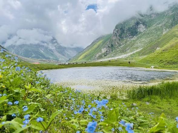
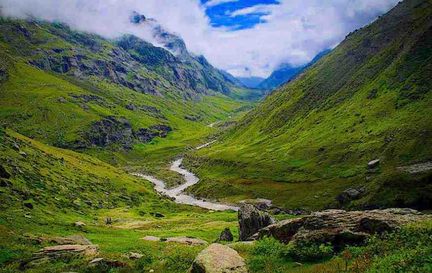
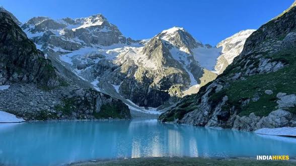
Hampta Pass lies on a traditional route across the Pir Panjal range and is often approached from Manali. The trek showcases contrasting ecosystems: alpine meadows (known locally as khads), pine and birch forests, rushing streams, moraines and, on the Lahaul side, arid high-altitude plains. Typical access begins near the village of Jobra or Gulaba and moves toward Chikka and the pass before descending to Chatru, Batal or Siagoru depending on the chosen itinerary.
Route and Itinerary Options
Classic Manali–Jobra–Hampta Route
This common itinerary starts with a short drive from Manali to Jobra (also spelled Jobri or Jwara). From Jobra, camps or homestays at initial nights are common before trekking to Shea Goru or Chikka and then to the pass. Most itineraries cross the pass and descend toward Batal or Chatru; vehicles may be available from Batal to key roadheads.
Alternative Approaches
Alternate approaches include starting from Gulaba or extending into the Lahaul valley at Batal to reach high-altitude plains such as Chandratal (with additional acclimatization and planning). Trekking companies and local guides may offer loop routes that vary in length from two to six days.
Preparing for the Trek
Fitness and Acclimatization
Though technically moderate, the Hampta Pass trek requires good cardiovascular fitness and hill-walking experience. Gradual ascent and at least one acclimatization day at 2,000–3,000 m (for those arriving from low altitude) reduce risk of altitude-related issues. Familiarity with walking on scree and snow patches is helpful.
Gear and Packing
Essential items include layered clothing for cold and sudden weather changes, waterproof outerwear, sturdy trekking boots, trekking poles, sun protection, and a warm sleeping bag rated for sub-zero temperatures. If camping independently, tents and cooking equipment are required; many trekkers use local camping operators that provide tents, meals and staff.
Permits, Regulations, and Safety
Permits and Local Rules
Permits may be required for certain approaches and for groups. Local forest or district authorities can provide up-to-date requirements; the Himachal Pradesh tourism department and Indian Mountaineering Foundation offer guidance on regulated treks and safety standards. For official travel advisories and national guidance, consult the Ministry of Tourism, Government of India: tourism.gov.in.
Weather, Hazards and Emergency Planning
Weather in the high Himalaya changes rapidly. Snowfields can remain late into the season; sudden storms and temperature drops are possible. Carry reliable communication devices, inform local authorities or trek operators of planned routes, and have contingency plans for evacuation. Use evacuation services only when directed by rescue authorities.
Flora, Fauna and Landscape Highlights
The lower reaches feature coniferous forests (deodar, pine, fir) and rhododendron at certain elevations. Meadows burst into color in summer with alpine flowers. Wildlife sightings can include mountain birds, Himalayan marmots and ibex in higher, rocky sectors. The scenic contrast—verdant Kullu meadows giving way to the austere Lahaul basin—is a key attraction.
Practical Information
Best Time to Visit
The trekking season typically runs from June through early October. Prior to June, heavy snow can block approaches; after October, weather becomes unpredictable and roads may close for winter. Monsoon months bring lush scenery but also increased risk of landslides on approach roads.
Accommodation and Logistics
Options near trailheads include guesthouses, homestays and camps. Manali serves as the main staging point with transport options and gear shops. When booking a guided trek, verify that the operator follows local regulations and employs trained staff.
Responsible Trekking
Follow Leave No Trace principles: pack out litter, minimize campfire impact, avoid disturbing wildlife, and respect local communities and grazing patterns. Support the local economy by hiring certified guides and using local accommodation where possible.
When to Seek Expert Advice
For high-altitude medical concerns, technical rescue, or complex route variations, consult accredited authorities such as the Indian Mountaineering Foundation or local health and rescue services. Mountain conditions change; official guidance should be checked before embarking.
Further Reading and Sources
Information in this guide is based on established trekking practice and regional sources including state tourism departments and mountaineering organizations. For official notices related to travel and tourism, see the national Ministry of Tourism website linked above.
Is Hampta Pass suitable for beginners?
Hampta Pass can be appropriate for hikers with some mountain trekking experience and basic fitness. Beginners should prepare with shorter high-altitude hikes first, travel with an experienced operator or guide, and allow time for acclimatization to reduce altitude risks.
What is the best time to trek Hampta Pass?
The best time is generally June to September when the pass is most accessible and campsites are free of deep snow. Early season may have residual snow; late season brings colder temperatures and shorter days.
How high is Hampta Pass and how hard is the ascent?
Hampta Pass is around 4,270 meters (about 14,009 feet). The ascent involves steep sections and variable terrain including scree and patches of snow; fitness, proper gear and acclimatization make the route manageable for many trekkers.
Are permits required for the Hampta Pass trek?
Permit requirements vary by route and local regulations; checking with district forest offices or state tourism authorities before travel is recommended. Guided groups often have permits arranged by the operator.
What emergency services are available on the route?
Emergency services vary by remoteness and season. Inaccessible areas may require helicopter evacuation coordinated by state authorities. Carry emergency contact numbers and a personal locator beacon or satellite communication device if available, and register plans with local authorities or the trek operator.