Kuari Pass Trek Itinerary: Day-by-Day Guide, Best Time and Practical Tips
-
- February 24th, 2026
- 1,360 views

FREE SEO Topical Map Generator: Find Your Next Content Ideas
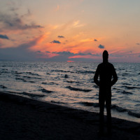
The Kuari Pass trek itinerary is a popular route in the Garhwal Himalaya of Uttarakhand, India, known for wide alpine meadows, panoramic views of Nanda Devi and Chaukhamba, and a mix of cultural villages and high-altitude landscapes. This guide outlines a practical day-by-day plan, seasonal advice, permit basics and safety considerations for a typical 4–6 day trek.
- Location: Garhwal Himalaya, Uttarakhand; usual start point Joshimath/Auli.
- Typical duration: 4–6 days (flexible for acclimatization).
- Difficulty: Moderate — suitable for fit beginners with prior day-hike experience.
- Best season: May–June and September–November.
- Permits: Local forest/trekking permits often required; check Uttarakhand officials.
Kuari Pass trek itinerary: Day-by-day outline
Overview and approach
The trek is typically approached from Joshimath (road access) with day options to Auli by road or cable car. The route crosses Gorson Bugyal (an expansive meadow), proceeds to high camps such as Khulara or Tali and reaches a high saddle often referred to as Kuari Pass or Phulara Ridge. Distances, elevation gains and campsite choices vary by operator and exact starting point.
Day 0 — Arrival and acclimatization (Joshimath)
Arrive in Joshimath to complete last-minute gear checks, procure supplies and obtain local permits if required. Use this day to rest and acclimatize to altitude; short walks in town help reduce immediate exertion when the trek begins.
Day 1 — Joshimath to Auli to Gorson Bugyal
Drive or take the cable car to Auli, then trek to Gorson Bugyal. Expect a gradual gain onto wide meadows with clear views of peaks such as Nanda Devi and Mana Parbat on clear days. Typical trekking time: 3–5 hours depending on pace and stops.
Day 2 — Gorson Bugyal to Khulara/Tali
The route climbs through mixed rhododendron and alpine scrub to higher meadows and campgrounds (Khulara or Tali on many itineraries). Distance can be moderate but includes steeper sections; this day helps further acclimatization.
Day 3 — Summit day: Kuari Pass and return
Early morning ascent to the Kuari Pass saddle for sunrise views of the main Garhwal peaks. The summit section is usually a high ridge offering panoramic vistas; return to the high camp for the night. Allow flexible time for weather conditions and photography.
Day 4 — Descent to Auli and return to Joshimath
Descend via the same route back to Auli and then to Joshimath by road or cable car. This final trekking day is mostly downhill and usually shorter.
Alternative extensions
Itineraries can be extended by adding extra acclimatization days, exploring nearby meadows, or combining with treks toward Harsil or the valley approaches to Badrinath for a longer circuit. Local guides can recommend variations based on fitness and weather.
Planning, permits and official guidance
Permits, local authorities and safety
Permits are sometimes required from the Uttarakhand Forest Department or local authorities for trekking and camping in certain zones. Regulations change seasonally and by zone; contact the state tourism department or the local forest office before travel. For official information and updates, consult the Uttarakhand tourism portal: uttarakhandtourism.gov.in.
Recommended coordination
Use registered local guides and licensed trekking operators where available. The Indian Mountaineering Foundation and state forest departments provide safety standards and recommended practices for alpine treks; ensure group sizes, waste disposal and camp behavior follow local regulations.
Practical advice: gear, fitness and weather
Packing checklist
- Layered clothing: base, insulating and waterproof shell.
- Sturdy trekking boots, gaiters and trekking poles.
- Warm sleeping bag rated for cold nights, personal first-aid kit, sunscreen and sunglasses.
- Water purification, high-energy snacks and a reusable water bottle.
- Map, compass or GPS device; mobile phone with backup power.
Fitness and acclimatization
Gradual ascent and hydration reduce risk of altitude-related issues. Include rest days if coming from low elevations and monitor symptoms of headaches, nausea or breathlessness. Seek local medical advice for severe signs. Hiking experience on uneven trails and basic camping familiarity are helpful.
Weather and best time to go
Pre-monsoon (late spring) and post-monsoon (autumn) are the preferred windows for stable weather, clear mountain views and accessible trails. Winter brings snow and technical conditions requiring specialized equipment; monsoon months are prone to landslides and reduced visibility.
Environmental and cultural considerations
Leave No Trace and community impact
Practice Leave No Trace principles: carry out waste, minimize campfire use, and respect grazing fields and local water sources. Engage local porters and guides to support community livelihoods. Cultural sensitivity toward village customs and religious sites contributes to a responsible trekking experience.
Wildlife and terrain
Habitats along the trail support Himalayan birds and small mammals. Keep a safe distance from wildlife, store food securely and follow guidance from local authorities on protected areas and season-specific restrictions.
How to prepare logistics
Transport and accommodation
Major transport hubs include Haridwar, Rishikesh and Dehradun; onward road travel to Joshimath is common. Accommodation options range from guesthouses in Joshimath to tented camps on the trail. Book peak-season services in advance.
Costs and budgeting
Costs vary by group size, guide services, transport mode (e.g., cable car to Auli), and camping style. Include contingency for weather delays, permit fees and emergency evacuation plans.
Emergency preparedness
Altitude and evacuation
Establish an emergency plan: local hospital locations, nearest helicopter evacuation services and contact numbers for district authorities. Share itinerary with a local authority or lodge and maintain daily check-ins when possible.
FAQs
What is the best Kuari Pass trek itinerary?
A common and practical itinerary runs 4–6 days: arrive and acclimatize in Joshimath, trek from Auli to Gorson Bugyal, move to Khulara/Tali, make an early ascent to Kuari Pass, then descend to Auli and return to Joshimath. Adjust for acclimatization and weather.
How difficult is the Kuari Pass trek?
The trek is considered moderate: trails are well-defined but include sustained uphill sections and exposure to high-altitude weather. Good cardiovascular fitness and prior day-hike experience are recommended.
Do permits or guides are required for Kuari Pass?
Permit requirements vary by zone and season; check with Uttarakhand authorities and consider hiring a registered local guide to handle permits, route-finding and local regulations.
When is the best time to attempt this trek?
Late spring (May–June) and autumn (September–November) offer the most reliable weather and visibility. Winter is snowy and may require technical gear; monsoon is generally discouraged due to trail hazards.
How to reduce the risk of altitude sickness?
Allow gradual ascent, stay hydrated, eat well, avoid alcohol and include rest or acclimatization days. If symptoms worsen, descend and seek local medical assistance promptly.
Are camping and accommodation available on the route?
Yes. Options include established campsites on meadows and basic guesthouses in Joshimath/Auli. Confirm facilities with the trekking organizer and carry necessary camping gear if planning to camp.
References: consult state tourism and forest department notices, Indian Mountaineering Foundation guidelines and local authorities for the latest safety and permit information before travel.