How Real Estate Drone Photography Transforms Property Marketing and Inspections
-

- February 23rd, 2026
- 1,512 views

👉 Best IPTV Services 2026 – 10,000+ Channels, 4K Quality – Start Free Trial Now
Real estate drone photography has become a pivotal tool for property marketing, inspections, and site mapping, offering aerial perspectives that traditional photography cannot capture. This technique combines unmanned aerial vehicle (UAV) platforms with high-resolution cameras and image-processing workflows to produce photos, video, and georeferenced maps used across residential, commercial, and land markets.
Real estate drone photography improves visual listings, accelerates inspections, and supports land analysis. Key advantages include wider coverage, cost efficiency versus some manned alternatives, improved marketing engagement, and integration with mapping technologies. Regulatory compliance, operator training, and privacy considerations are essential.
Real Estate Drone Photography: Impact and Advantages
Adopting real estate drone photography changes how properties are presented and assessed. Aerial images and cinematic video sequences provide context—showing property boundaries, nearby amenities, topography, and roof conditions—helping buyers and sellers understand a listing at a glance. For developers and brokers, drone footage can highlight lot orientation, views, and access routes that ground-level images often miss.
Key Benefits
Enhanced Marketing and Listing Appeal
High-quality aerial visuals increase listing engagement on websites and social platforms. Drone photography enables dynamic walkthroughs and bird's-eye stills that make online listings more competitive. Studies on online real estate behavior indicate listings with compelling visual content typically receive more views and longer viewer sessions.
Efficient Property Inspections
Drones accelerate inspections for roofs, chimneys, solar arrays, and exterior façades. They reduce the need for ladders, lifts, or scaffolding in many cases and can capture images from angles that are difficult or unsafe for manual inspection.
Surveying and Mapping Integration
When combined with photogrammetry software, drone imagery can produce orthomosaics, digital surface models (DSMs), and basic site surveys. This supports site planning, volume calculations for grading or stockpiles, and integration with geographic information systems (GIS).
Common Use Cases
Residential and Luxury Listings
Aerial views emphasize property scale, landscaping, pools, and proximity to parks or water. Luxury markets especially benefit from cinematic footage that showcases unique features and vistas.
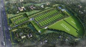
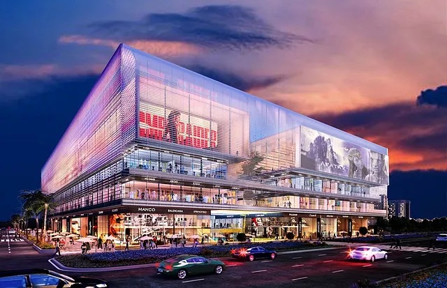
Commercial Properties and Development Sites
Commercial brokers use drone photography to present parking layouts, building footprints, and access patterns. For development projects, regular aerial surveys document construction progress and site changes over time.
Inspection and Maintenance
Facilities managers and inspectors use drones for condition assessments, roof inspections after storms, and monitoring of large assets, reducing time on-site and exposure to hazardous conditions.
Best Practices and Technical Considerations
Image Quality and Techniques
Use cameras with adequate resolution and dynamic range to capture detail in highlights and shadows. HDR capture, controlled flight paths, and consistent altitudes improve stitching for panoramas and orthomosaics. Stabilized gimbals help produce smooth video suitable for promotional reels.
Operational Planning
Preflight checks, weather assessment, and defined flight plans reduce risk. Establish clear objectives—marketing photos, inspection imagery, or mapping—before the flight so sensors and altitudes can be configured correctly.
Data Processing and Delivery
Post-processing workflows often include color grading, noise reduction, stitching, and georeferencing. Deliverables may include edited stills, short promotional videos, orthomosaic maps, or annotated inspection reports.
Regulatory and Privacy Considerations
Operating drones for commercial purposes typically requires compliance with national aviation regulations and operator certification. Rules may govern maximum altitudes, line-of-sight operation, and restrictions near airports or over people. For operations in the United States, refer to the Federal Aviation Administration (FAA) guidance for small unmanned aircraft systems: Federal Aviation Administration (FAA). Privacy laws and neighborhood expectations should guide image capture to avoid intrusive surveillance of private spaces.
Measuring Effectiveness
Performance Metrics
Effectiveness can be measured by engagement metrics (listing views, time on page), lead quality, inspection time savings, and reduced need for scaffolding or manual access. Establishing baseline metrics before drone adoption helps quantify improvements over time.
Cost and Return Considerations
Costs include equipment, pilot training or contractor fees, and post-processing. For many users, the combination of improved listing performance and faster inspections offsets these expenses, especially in competitive or high-value markets.
Implementation Tips
Choose Qualified Operators
Use pilots with demonstrated experience in property photography and familiarity with local regulations. Confirm insurance coverage and review sample portfolios for image style and quality.
Integrate with Marketing and Inspection Workflows
Coordinate drone shoots with listing schedules, marketing campaigns, and inspection windows. Store imagery in a structured asset library to enable reuse for flyers, virtual tours, and future site comparisons.
Maintain Ethical Practices
Respect privacy and community guidelines. Obtain consent where required and avoid capturing images that identify individuals without permission.
Frequently Asked Questions
What is real estate drone photography and how is it used?
Real estate drone photography uses unmanned aerial systems to capture aerial stills, video, and survey data for property marketing, inspections, and mapping. It highlights property context, documents site conditions, and can support progress documentation for construction projects.
Are drones legal for commercial property photography?
Many jurisdictions require operator certification, registration of aircraft, and adherence to specific operational rules. Consult national aviation authorities and local regulations before conducting commercial flights.
How does drone imagery improve listing performance?
Aerial images and cinematic video provide unique perspectives that attract viewer attention, increase time on listing pages, and can improve perceived value by showing property features and surroundings more clearly.
What are typical deliverables from a drone flight?
Deliverables may include edited aerial photos, promotional video clips, orthomosaic maps, elevation models, and annotated inspection images, depending on project objectives.
How should privacy and safety be handled during flights?
Plan flights to avoid capturing private interiors or neighbors without consent, maintain safe distances from people and property, and follow local privacy laws and aviation safety rules.